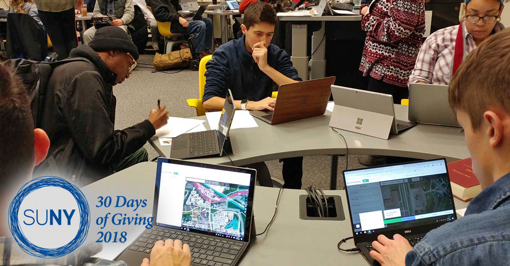
Over 20 students, faculty, and staff recently participated in Monroe Community College’s third annual mapping party. As part of their contributions to openstreetmap, a free and editable map of the world that activists use to support humanitarian efforts and community development, attendees mapped buildings in Senegal to collect data on buildings, roads, and drainage needed to address impacts from erosion as a result of sea level rise and flood events.
Senegal is especially vulnerable to coastal erosion and flooding annually affects 200,000 inhabitants. Rising sea levels and increasingly hazardous storms are risks to Senegal housing, where 74% of housing is vulnerable to flood risk.
Monroe’s third annual mapping party findings from the mapping task will reduce the country’s vulnerability to natural hazards. The event was hosted by MCC’s Mapping Club, Geography/Geo-spatial program, the Global Education and International Services Office, and the Student Events and Governance Association. Monroe Community College’s Mapping Club focuses on humanitarian mapping, where people come together in times of a crisis such as a natural disaster and provide and analyze data needed to rebuild the community.
30 Days of Giving 2018
- Day 1: Buffalo State’s Students Serve as Civic Leaders
- Day 2: Farmingdale State College Students Give Veterans a Smile
- Day 3: Tompkins Cortland Community College Brings the Farm to the Table
- Day 4: SUNY Maritime Donates Backpacks to Homes For the Brave
- Day 5: Paws and Effect at Binghamton University
- Day 6: New Paltz Students Go From Interns To Emerging Leaders
- Day 7: Niagara County Community College Students Feed Animals in Need
- Day 8: Mohawk Valley Community College Baseball Team Helps Area Veterans
- Day 9: SUNY Delhi Students Build Homes for the Homeless
- Day 10: SUNY Old Westbury Commemorates Veterans
- Day 11: UAlbany Students Work to Improve Lives of Those With Disabilities
- Day 12: Alfred State Students Preserve History in California
- Day 13: Herkimer County Community College Cares For the Community
- Day 14: SUNY Broome Students Stepping Up to End Campus Hunger
- Day 15: Monroe Community College Develops Humanitarian Mapping
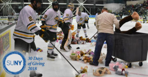
- Day 16: SUNY Oswego Hockey Teams Support Local Charities
- Day 17: Stony Brook University Students Practice Prevention and Outreach
- Day 18: SUNY ESF Students Give Up Their Saturdays for Service
- Day 19: Clinton Community College Helps Students Overcome Barriers to Success
- Day 20: SUNY Plattsburgh Grants Holiday Wishes to Area Children and Families
- Day 21: SUNY Cobleskill Gives Back to the Iroquois Indian Museum
- Day 22: SUNY Sullivan Helps Local Federation for the Homeless
- Day 23: Operation Shoebox at Schenectady County Community College
- Day 24: University at Buffalo Grassroots Gardens
- Day 25: SUNY Oneonta Runs to Fight Hunger
- Day 26: SUNY Orange Helps the Needy Stay Warm in Winter
- Day 27: HVCC Students Pack Good Night Bags for Families in Crisis
- Day 28: SUNY Fredonia Adopts Families in Need
- Day 29: Onondaga Community College Students Give Back With Service Abroad
- Day 30: Jefferson Community College Faculty & Staff Take Pie in the Face for Charity